


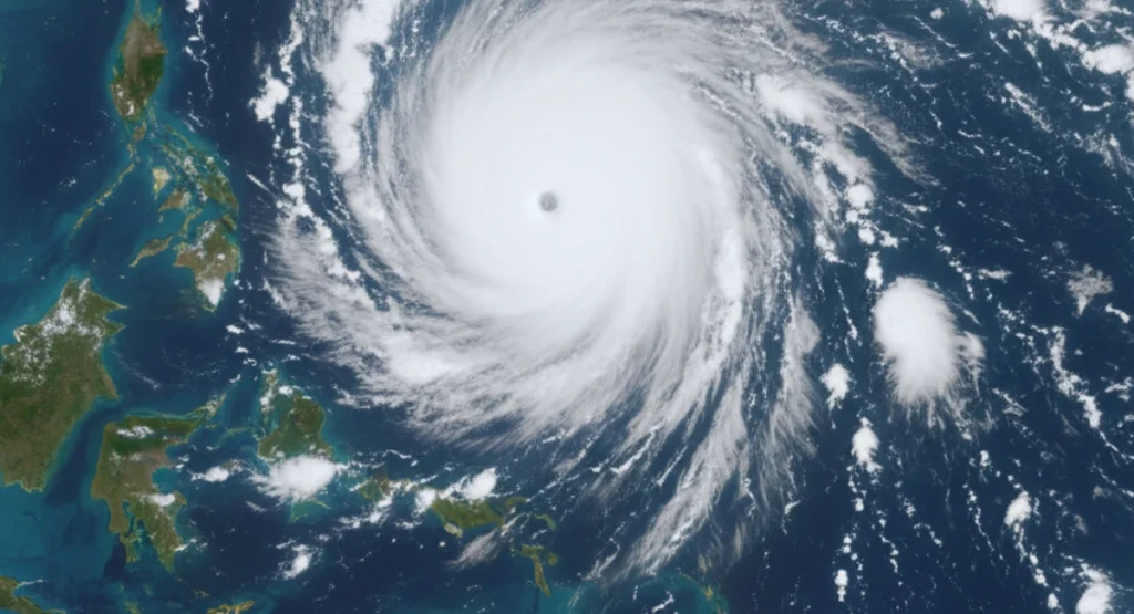
Tropical Cyclone Fina is getting stronger as it moves closer to Australia’s Northern Territory (NT).
The new forecast shows that the storm may intensify further and bring serious weather to coastal communities. In this report, I explain the latest track update in clearly.
Where Cyclone Fina Is Right Now
Cyclone Fina is currently located over warm waters north of Australia, near the Arafura Sea and Timor Sea region.
The system is moving southwest, slowly shifting toward the NT coastline.


“Early storm clouds forming along the NT coast as Cyclone Fina approaches.”
The cyclone is close enough now that weather conditions are expected to change quickly across the Top End.
Cyclone Strength and Category
According to the latest data:
- Cyclone Fina is a Category 2 system
- Wind speeds: 110–125 km/h
- Gusts may reach 150–160 km/h
Meteorologists say the storm could reach Category 3 within the next 24 to 48 hours.
Why Cyclone Fina Is Getting Stronger
Cyclone Fina is growing more powerful because the environment around it is helping the system intensify.
- Very warm ocean water
Sea temperatures are around 30–31°C, which is perfect fuel for cyclones.
- Low wind shear
This means the wind at different heights is not disrupting the storm.
The cyclone can build a stronger center.
- Moist tropical air
A monsoon trough is feeding the storm with warm, moist air.
This increases rainfall and wind strength.
Areas Most at Risk
The following regions may experience strong weather as the cyclone moves closer :
- Darwin
- Tiwi Islands
- Top End coastal areas
- Croker Island
- Nhulunbuy and Arnhem Land
- Katherine (secondary impacts)
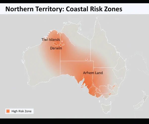
“Key NT regions most likely to experience strong winds and heavy rain from Cyclone Fina.”
Possible Impacts
- Damaging winds
- Very heavy rain
- Flash flooding
- Coastal water rise
- Power outages
- Disrupted travel and transport
- Next 12–24 hours:
When Will the Cyclone Peak?
Next 12–24 hours:
Cyclone continues to strengthen.
Next 48 hours :
Highest chance of reaching Category 3.
Friday–Saturday :
The cyclone is expected to be closest to the NT coastline.
A landfall remains possible depending on final track changes.
Two Possible Track Scenarios
Scenario A – Direct Hit on NT Coast
This would bring strong winds, flooding, dangerous seas, and storm surge.
Scenario B – Moves Close but Turns West
This still brings heavy rain and rough sea conditions, even without direct landfall.
Both scenarios show significant risk, which is why alerts remain in place.
What the Bureau of Meteorology (BOM) Says
The Bureau of Meteorology has issued new alerts for the NT region as Fina moves closer, and its latest cyclone update also shows the system strengthening :
- Cyclone Watch / Warning for parts of NT
- Alerts about possible rapid intensification
- Maps showing a closer track toward NT communities
BOM has also said that residents should take this system “very seriously” because track changes can happen quickly.
“BOM shared this latest track update showing Cyclone Fina’s current position and expected movement toward the NT coast.”
What Satellite Images Show
Latest satellite imagery shows :
- Strong thunderstorms around the cyclone’s center
- Cooling cloud tops (a sign the storm is growing stronger)
- Spiral rainbands tightening
- Better outflow patterns
Latest satellite images also show stronger thunderstorms near the centre of the system, as seen in BOM’s live satellite imagery. These changes confirm that Cyclone Fina is still intensifying.
“Weatherzone’s radar view shows how the storm’s core is becoming more organised as it moves closer to the NT.”
Advice for Residents
Here are simple safety steps recommended during cyclone alerts:
- Follow all BOM updates
- Stay away from coastal areas
- Keep emergency kits ready
- Secure loose outdoor items
- Charge phones and keep power banks ready
- Avoid travel unless necessary
I always tell readers that cyclone tracks can change fast. Please depend on official updates before making decisions. The NT Government also reminds people to check basic safety steps before a cyclone, especially things like securing loose items and preparing a small emergency kit.
The Bigger Climate Picture
Warmer oceans in northern Australia are making cyclones stronger and less predictable.
Scientists say rapid intensification events like this are becoming more common during cyclone seasons.
Scientists in Australia also note that warm ocean temperatures can influence how strong tropical cyclones become, something highlighted in CSIRO’s research on cyclone patterns.
Final thoughts
Cyclone Fina is strengthening and moving toward the NT coast.
With the possibility of reaching Category 3, the storm remains a serious threat.
Residents should stay alert and follow the latest updates from BOM as the situation may change quickly.
Disclaimer :
This update is based on currently available weather data. Forecasts may change as new information becomes available. Always follow official alerts from the Bureau of Meteorology (BOM).


Contents
- 1 Tropical Cyclone Fina is getting stronger as it moves closer to Australia’s Northern Territory (NT).The new forecast shows that the storm may intensify further and bring serious weather to coastal communities. In this report, I explain the latest track update in clearly.
- 2 Where Cyclone Fina Is Right Now
- 3 Cyclone Strength and Category
- 4 Why Cyclone Fina Is Getting Stronger
- 5 Areas Most at Risk
- 6 Possible Impacts
- 7 When Will the Cyclone Peak?
- 8 Two Possible Track Scenarios
- 9 What the Bureau of Meteorology (BOM) Says
- 10 What Satellite Images Show
- 11 Advice for Residents
- 12 The Bigger Climate Picture
- 13 Final thoughts
- 14 Disclaimer :