A Coastline on the Edge
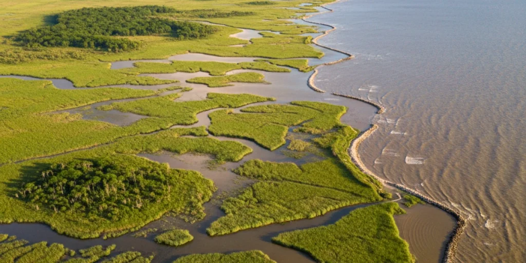
I still remember the first time I saw satellite images of Louisiana’s coast — it looked like someone had taken a bite out of the state. Over the past few decades, that “bite” has grown fast. According to the U.S. Geological Survey, Louisiana has already lost more than 2,000 square miles of land since the 1930s.
That’s about the size of Delaware — gone, swallowed by the Gulf of Mexico.
According to the U.S. Geological Survey, Louisiana has already lost more than 2,000 square miles of land since the 1930s — roughly the size of Delaware. Experts estimate that a football field of coastal land disappears every hour, eroded by rising seas, storms, and decades of human alteration.
To confront this loss, the state has launched one of the largest environmental undertakings in U.S. history — a $50 billion Coastal Master Plan. Designed by the Coastal Protection and Restoration Authority (CPRA), the plan aims to rebuild wetlands, strengthen levees, and adapt entire communities to a changing shoreline.
But behind the billion-dollar headlines lies a race against time. As climate pressures intensify, Louisiana’s coastal future will depend on whether this plan can deliver faster than the Gulf can take away.
The Scale of the Crisis
The speed of Louisiana’s coastal erosion has alarmed scientists for years — and for good reason. According to the U.S. Geological Survey’s , the state’s coastline is vanishing faster than anywhere else in the continental United States. In the time it takes to read a few paragraphs, another piece of land may already be gone.
The reasons are layered and deeply connected. Rising sea levels continue to drown low-lying marshes. Oil and gas canal dredging, a legacy of decades of industrial expansion, has weakened the wetlands that once acted as natural storm buffers. Meanwhile, the levee system that protects the Mississippi River’s banks from flooding also blocks the very sediment that once rebuilt the delta each year.
A 2024 report from the U.S. Geological Survey warns that the combined impact of stronger hurricanes and higher tides could accelerate land loss over the next two decades. Each storm now erases ground that nature no longer replenishes.
This loss extends far beyond geography. Wetlands are not just ecological assets — they are Louisiana’s storm shield, economic backbone, and cultural identity. They protect coastal towns from hurricanes, support multi-billion-dollar fisheries, and preserve traditions rooted in the delta’s rhythm.
Without them, Louisiana faces a future where storms hit harder, industries weaken, and the line between land and sea begins to blur.
- “Locals continue to raise concerns about real, long-term issues — and coastal erosion remains one of the most urgent.”
The $50 Billion Master Plan — What It Actually Includes
At the heart of Louisiana’s response is the Coastal Master Plan, a sweeping 50-year strategy that mixes science, engineering, and community planning. First introduced in 2007 and updated every six years, the latest 2023 edition maps out more than $50 billion in projects designed to rebuild land and reduce flood risk for millions of residents living along the Gulf.
According to the Coastal Protection and Restoration Authority (CPRA), the plan prioritizes three intertwined goals: restore wetlands, fortify communities, and adapt to rising seas. It’s not one mega-project, but a network of hundreds of efforts — from redirecting the Mississippi River’s sediment to reinforcing levees and elevating vulnerable homes.
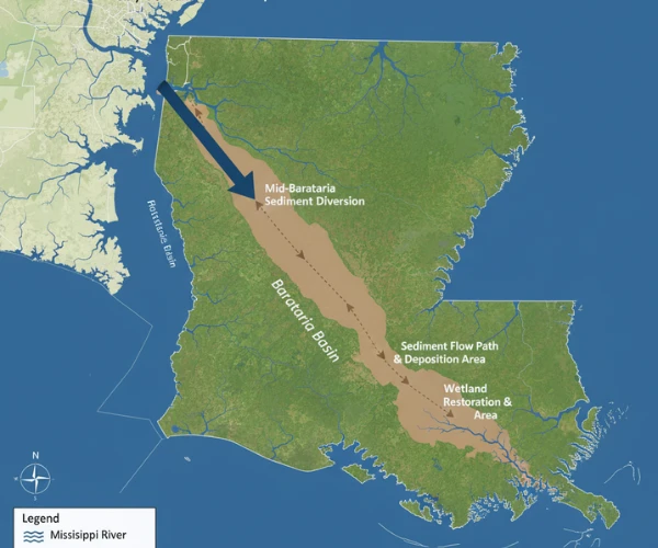
One of its cornerstones, the Mid-Barataria Sediment Diversion, aims to release up to 75,000 cubic feet of river water per second into the Barataria Basin. By letting the river naturally deposit sediment, engineers hope to rebuild 20,000–30,000 acres of wetlands over the coming decades. It’s an audacious experiment — essentially asking the Mississippi River to do again what it once did on its own.
Beyond river diversions, the plan includes barrier-island restoration, such as recent work on Raccoon Island, where nearly three million cubic yards of sand were added to strengthen bird habitats and slow erosion. Other initiatives focus on marsh creation, ridge restoration, and flood-protection structures stretching from New Orleans to Calcasieu Parish.
Yet, the Master Plan goes beyond construction. Roughly $6 billion is reserved for non-structural programs — raising homes, relocating families, and updating local flood-insurance maps. Officials describe it as a move toward “living with water” rather than fighting it.
Still, experts caution that even a plan of this scale faces obstacles. Funding cycles depend heavily on federal oil-and-gas revenue, and long-term political support can shift with each administration. Environmental groups also warn that diverting river water could disrupt fisheries and alter salinity in coastal bays.
Despite the debate, the Coastal Master Plan remains Louisiana’s clearest roadmap to survival. It’s a rare attempt to turn decades of loss into a blueprint for resilience — one where science and policy meet at the edge of a sinking shore.
Sediment Diversion Projects (The Core Strategy)
One of the main parts of Louisiana’s plan is the Mid-Barataria Sediment Diversion in Plaquemines Parish. It is one of the largest ecosystem projects in U.S. history.
The project will redirect up to 75,000 cubic feet of Mississippi River water every second into the Barataria Basin. This will allow mud and sand from the river to rebuild wetlands naturally, just like the river used to do before levees stopped it.
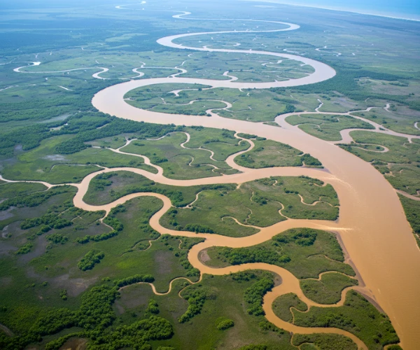
The total cost is around $3 billion, and it was approved by the U.S. Army Corps of Engineers in 2023.Supporters say it could restore 20,000 to 30,000 acres of marshland over the next few decades.But critics warn that it may harm local fisheries and affect communities that depend on shrimp and oysters.
Louisiana’s leaders have voiced strong opinions on the project’s future — balancing ecology, economy, and culture remains a struggle.
Science vs. Reality — Can It Work?
Louisiana’s plan is built on strong science, but the real-world challenges are huge. Engineers and scientists believe that river sediment can rebuild the coast if it is redirected in the right way. Projects like the Mid-Barataria Sediment Diversion are meant to let the Mississippi River carry mud and sand back into sinking wetlands.
Early tests and small projects show positive signs. At Raccoon Island, new sand restored bird habitats and reduced erosion. In some restored marshes, grasses have started growing again, showing that land can return if nature is given help.
Still, experts warn that science moves slower than the sea. Rising temperatures, stronger hurricanes, and fast sea-level rise could undo years of progress. Even the biggest diversion projects will take 10 to 15 years before land growth is clearly visible.
There are also economic and social risks. Fishermen fear that new diversions will change the salt levels in coastal waters and affect shrimp and oyster harvests. Local communities worry about relocation and job losses if coastlines shift further inland.
Funding remains another obstacle. The plan depends on federal oil-and-gas revenue, which can fluctuate with market prices and politics. Without steady money, many of the 77 projects in the master plan could face delays.
Despite the doubts, scientists agree on one point: doing nothing is not an option. The plan may not stop every inch of land loss, but it offers Louisiana its best scientific chance to slow the sinking coast and protect the people who live there.
Raccoon Island Restoration
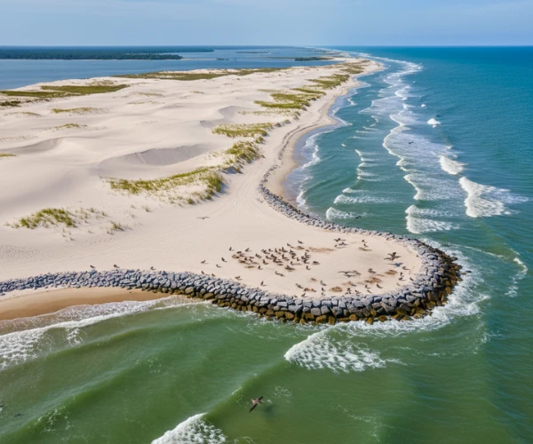
The Raccoon Island Restoration Project is part of the Barrier Island Restoration Program. It is located off Terrebonne Parish and one of its major phases was completed in 2023.
The project added about 2.8 million cubic yards of sand to rebuild bird habitats and strengthen storm protection.
Thanks to these efforts, the island now supports 30% more nesting seabirds than before, according to the U.S. Fish and Wildlife Service (2024).
Economic & Climate Context
Louisiana plays a major role in the U.S. energy sector, producing about 18% of the country’s oil and gas and holding 30% of its refinery capacity.
This makes the state economically important — but also highly exposed to the effects of climate change.
The NOAA Climate Risk and Resilience Study (2024) says Louisiana could face a sea-level rise of up to 2 feet by 2050.
That rise could threaten nearly $150 billion worth of coastal assets, including homes, ports, and energy facilities.
This means Louisiana must balance its economic power with the urgent need to protect its fragile coastlines from the rising sea.
Challenges & Political Tensions
Even with strong planning, Louisiana’s coastal projects face serious challenges.
The biggest problem is funding delays, often caused by disagreements between state and federal agencies over how and when to release money.
Environmental experts also warn that the plan may not move fast enough to keep up with rising sea levels. As global temperatures increase, storms are becoming stronger and tides are pushing farther inland. Some scientists believe the current strategy will need to adapt quickly or risk falling behind nature’s pace.
Meanwhile, some communities have already reached a breaking point. Isle de Jean Charles, a small island south of Terrebonne Parish, has been relocated permanently after years of repeated flooding. It became the first federally funded climate relocation community in the United States — a sign of what may come for others.
Politics adds another layer of tension. There’s a divide between restoration and revenue — protecting the coast often means limiting offshore oil and gas drilling, which still provides much of the state’s income. Balancing economic interests with environmental urgency remains one of Louisiana’s hardest tasks.
Future Outlook
Despite the challenges, Louisiana’s coastal restoration efforts are moving forward.
The 2024 CPRA Annual Report shows that $1.3 billion has been allocated for 92 ongoing projects across the state — from river diversions to marsh rebuilding and flood protection systems.
The plan has started gaining global attention as a model for large-scale climate adaptation. Other coastal regions, from the Netherlands to Bangladesh, are watching how Louisiana combines engineering, community planning, and ecological restoration into one long-term strategy.
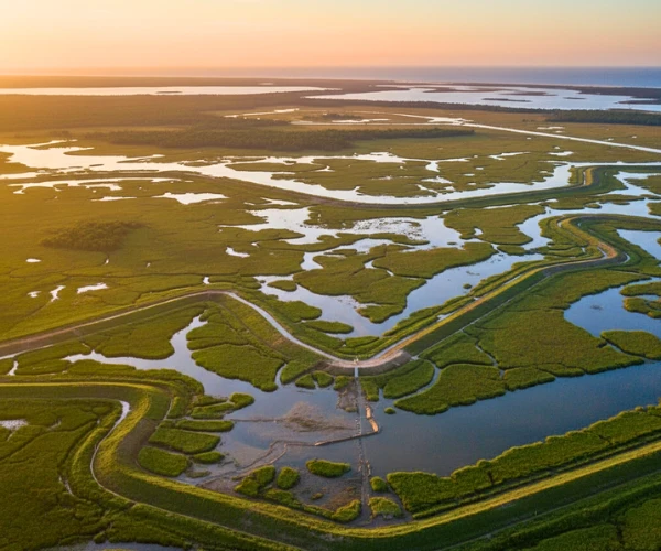
However, experts warn that time is running short. According to Climate Central’s Sea level projections (2024), if global emissions continue at the current pace, up to 200,000 Louisiana residents could face relocation by 2070.
Even with billions of dollars invested, Louisiana’s future depends on how well it can adapt — not just rebuild. The next few decades will decide whether the Gulf Coast can stay above water or slowly surrender to the sea.
Hope or Hype? What the Future Looks Like
As Louisiana moves deeper into its 50-year plan, the results are still a mix of hope and uncertainty.
On one side, there are visible wins — new islands, stronger levees, and wetlands slowly returning in areas where the river has been redirected. These projects show that nature can recover when given time and resources.
But the bigger picture is harder to predict. The climate is changing faster than anyone expected. Rising seas, frequent hurricanes, and unpredictable rainfall keep challenging every plan and budget. Even with billions invested, Louisiana may not save every piece of its coastline — some areas will likely be lost forever.
Still, experts agree that the Coastal Master Plan is not a failure, but a blueprint for survival. It offers valuable lessons for other coastal regions around the world — from how to live with water to how communities can adapt before disaster strikes.
In the end, Louisiana’s struggle is not only about rebuilding land — it’s about redefining resilience. The outcome will decide whether the Gulf Coast remains a home for millions or becomes one of the world’s first major examples of large-scale climate migration.
Disclaimer :
This article is written for informational and educational purposes only. It aims to raise awareness about coastal restoration, climate challenges, and community resilience. All information is based on publicly available data and intended to present an unbiased perspective.

Contents
- 1 A Coastline on the Edge
- 2 The Scale of the Crisis
- 3 The $50 Billion Master Plan — What It Actually Includes
- 4 Sediment Diversion Projects (The Core Strategy)
- 5 Science vs. Reality — Can It Work?
- 6 Raccoon Island Restoration
- 7 Economic & Climate Context
- 8 Challenges & Political Tensions
- 9 Future Outlook
- 10 Hope or Hype? What the Future Looks Like
- 11 Disclaimer :