Rain and Snow Expected in California Over Christmas Week: Travel Impacts and Simple Safety Tips
- A strong atmospheric river / Pineapple Express is lined up to hit California around Christmas, bringing several days of rain and mountain snow.
- Southern California could see 2–4 inches of rain on the coast and in the valleys, with a chance of even higher amounts in some spots.
- The Bay Area and Northern California face multiple waves of rain from the weekend into Christmas, with 1–3 inches possible in San Francisco by Monday and more in the North Bay.
- The Sierra Nevada is finally set for feet of snow, but that also means difficult travel and possible pass closures at times.
- Holiday travel by road and air could be disrupted across much of the state, especially Christmas Eve and Christmas Day.
Stormy Christmas Week Ahead for California
A busy line of storms is taking aim at California during Christmas week. As per statistics, a series of atmospheric rivers will keep sending heavy rain and mountain snow into the West Coast, with the focus shifting toward Northern and Central California as we move into the holiday period.
As I look at the latest maps and discussions from forecasters, it’s clear this will not be a calm, dry holiday stretch. Instead, we are looking at several days of wet roads, gusty winds and wintry mountain conditions.
What’s Fueling This Pattern?
Meteorologists describe this setup as a strong atmospheric river – sometimes called a Pineapple Express because the moisture tap stretches from near Hawaii to the West Coast.
- Imagine a river in the sky, carrying warm, moist air across the Pacific.
- When that air hits California’s mountains and coastline, it rises and cools, turning into heavy rain in the lowlands and snow higher up.
The National Weather Service Weather Prediction Center has already started issuing key messages for this event, warning of heavy rain and mountain snow across much of the state through December 26.
When Will the Storms Hit ?
Bay Area and Northern California :
As per data collected by San Francisco Chronicle the final weekend before Christmas could become the Bay Area’s wettest since last November, with 1–3 inches of rain possible in San Francisco by Monday morning.
Key timing from meteorologists :
Friday: Light to steady rain, not too intense.
Saturday: A brief lull, then rain becomes more widespread by evening as the core of the atmospheric river sharpens.
Sunday into Monday: The most important window. If the atmospheric river stalls near the region, multiple rounds of moderate to heavy rain could lead to saturated soils and localized urban or creek flooding.
As per details shared by abc7news for Northern California adds that storms fueled by the atmospheric river will bring strong winds and heavy Sierra snow, with some resorts expecting totals in the 30–70 inch range over several days.
Southern California
Down south, the Los Angeles Times reports that a powerful Pineapple Express storm is expected to bring a wet, white and potentially wild Christmas to the region.
According to forecasters quoted there:
- The peak of the storm for Los Angeles, Ventura, Santa Barbara and San Luis Obispo Counties will likely run from Tuesday through Christmas Eve and Christmas Day.
- The most likely outcome is 2–4 inches of rain on the coast and in the valleys, with a 30% chance of even higher totals above 4 inches in some areas.
The article also notes that this could be the first in a sequence of storms, with additional showers and storms possible through December 27 as more Pacific energy lines up.
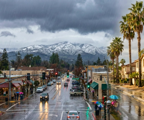
From rainy cities to snowy mountains, the same storm pattern will hit different parts of California in different ways this Christmas week.
Sierra Nevada
Experts agree that the Sierra could finally see a major reset to the season:
- Snow levels may start high but are expected to drop, allowing resort-level snow later Christmas Day into the 26th.
- Forecast models suggest feet of snow at higher elevations, though exact amounts will depend on how much cold air arrives with each storm.
For drivers, this means chain controls, whiteout conditions and even temporary freeway closures are on the table for the busiest holiday travel days.
Holiday Travel Impacts Across California
Meteorologist Drew Tuma warns that Christmas Eve and Christmas Day could be very tough travel days across much of California, from wet freeways to snow-covered mountain passes.
From what I’m seeing in the guidance and local reports, here are the main concerns:
Roads and Freeways
- Slick, flooded roadways in cities and valleys, especially where drains clog or heavy showers linger.
- Rockslides or debris flows on coastal and mountain routes, particularly near burn scars.
- Longer drive times on major corridors like I-5, Highway 101 and I-80, as more people hit the road for the holidays.
Mountain Passes
- Sierra passes and other high routes may see periods of heavy snow and near-zero visibility, with chain controls and possible closures.
If I were planning a trip to Tahoe or another mountain destination, I would treat the forecast as high-impact, not just “wintery”.
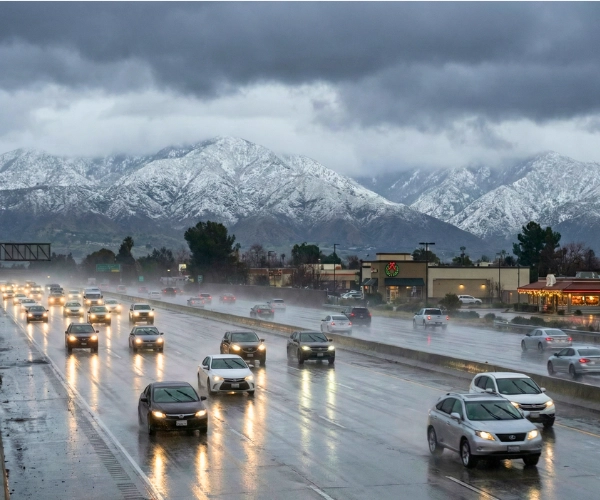
Stormy skies, wet freeways and snowy mountains could make Christmas week travel across California slower and more difficult.
Air Travel
- Low clouds, wind and heavy rain could cause delays or cancellations at major airports such as SFO, OAK, SJC, LAX and SAN, especially during the heaviest rain bands.
How This Fits the Bigger Weather Pattern
This stormy Christmas week fits into a much larger, active winter pattern across the United States. Earlier this month, a coast-to-coast system soaked many states from Washington to the East Coast, something we covered in our report on severe storms triggering widespread flooding across the U.S.
Farther east, winter has already shown up in very different ways. New York City just saw its first big snow of the season, with several inches across the Tri-State area and a sharp cold wave behind it, which we explained in detail in our article on New York City’s first snowfall milestone and the next cold wave.
The central and southern U.S. have also dealt with powerful Arctic air, where a sudden cold snap brought dangerous wind chills and icy travel. That event is covered in our sudden cold snap report for the South and Midwest.
Compared with those colder events, California’s Christmas setup is less about extreme temperatures and more about repeated moisture — storms arriving one after another, with each wave adding more rain and snow on top of already wet ground.
Simple Safety Tips for a Wet and Snowy Week
You don’t need a complicated plan to stay safer during this stretch. A few simple steps can make a big difference.
For Drivers and Travelers
- Check the forecast and road conditions before leaving, especially for long trips or mountain drives.
- Never try to drive through flooded roads. Even shallow water can hide deep holes or strong currents.
- Pack a car kit with: warm layers or blankets, water, snacks, a flashlight, phone charger and basic first-aid items.
- For mountain trips, carry tire chains, fill your tank and let someone know your route and expected arrival time.
For Homes and Neighborhoods
- Clear gutters, drains and street grates so rainwater can move away from homes.
- Move boxes and valuables off the floor in garages, basements or other low spots that sometimes take on water.
- Keep a small power-outage kit ready: flashlights, spare batteries, power banks and any important medications.
- Check in on elderly neighbors or friends who might need help during heavy rain or colder nights.
Always follow official guidance from your local National Weather Service office and emergency managers; if they issue flood warnings, evacuation orders or road-closure updates, those should guide your decisions first.
After Christmas: Could the Wet Pattern Continue?
Forecasters warn this Christmas storm may be the first in a series, with additional waves of rain and mountain snow possible into December 27 and even toward the New Year.
The atmosphere over the Pacific is still full of energy and moisture, so California may stay in an active pattern even after the main holiday has passed.
As I keep tracking these systems, the big picture is simple :
- This week’s storms are good for water supply and snowpack,
- but they also demand extra care on the roads, in the air and in the mountains.
With a bit of planning and awareness, Californians can enjoy a wet, white and safer Christmas week as the storms roll through.
Disclaimer : This article is for general information only and is based on forecasts available at the time of writing. Weather conditions can change quickly, so always follow the latest alerts and guidance from the National Weather Service, local authorities, and official travel or utility updates before making decisions.

Contents
- 1 Rain and Snow Expected in California Over Christmas Week: Travel Impacts and Simple Safety Tips
- 2 Stormy Christmas Week Ahead for California
- 3 What’s Fueling This Pattern?
- 4 When Will the Storms Hit ?
- 5 Bay Area and Northern California :
- 6 Southern California
- 7 Sierra Nevada
- 8 Holiday Travel Impacts Across California
- 9 Roads and Freeways
- 10 Mountain Passes
- 11 Air Travel
- 12 How This Fits the Bigger Weather Pattern
- 13 Simple Safety Tips for a Wet and Snowy Week
- 14 For Drivers and Travelers
- 15 For Homes and Neighborhoods
- 16 After Christmas: Could the Wet Pattern Continue?