


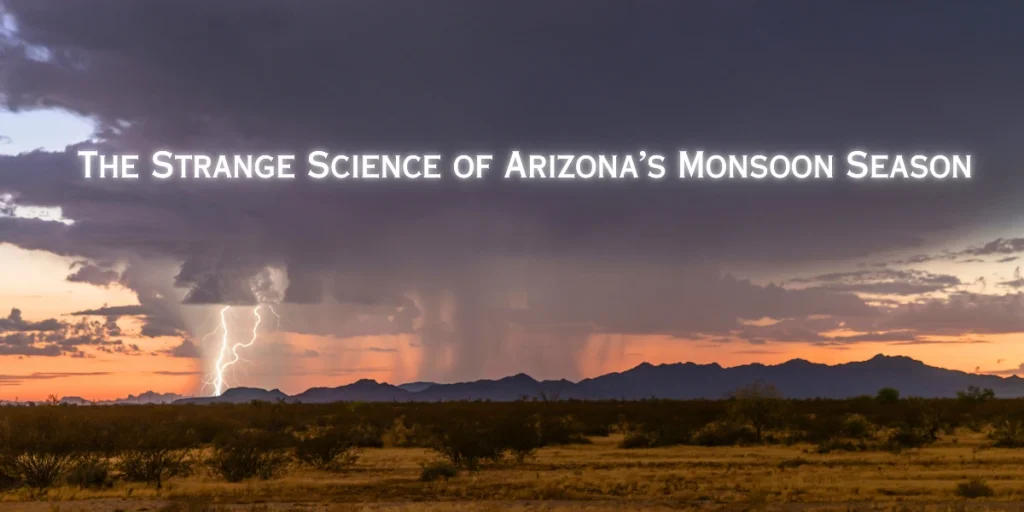
Why does a bone-dry desert suddenly breathe storms like an animal coming to life—sometimes gentle, sometimes wild? As a weather analyst who has chased, logged, and forecast Arizona’s monsoon for years, I’ve learned that the desert’s calm is more complicated than it looks.
In this piece, I’ll unpack the mechanics that flip the switch, why some summers feast and others starve, and how I forecast those “boom or bust” evenings that decide whether your patio dinner turns into a lightning show.
“Arizona’s monsoon is the moment the atmosphere reverses gears and the desert starts to inhale.”
What Exactly Is the Arizona Monsoon?
The North American Monsoon is a seasonal wind shift that pulls subtropical moisture into the Southwest U.S., especially Arizona and New Mexico, typically from mid-June through late September. In 2008, the National Weather Service standardized the “monsoon season” to June 15–September 30 for clarity across the region.
Older Phoenix-area definitions tied the “start” to a dew-point threshold; that worked locally but wasn’t consistent statewide. The standardized window made communication cleaner for public safety and record-keeping.
During this period, moisture increases, thunderstorm chances rise, and our skies trade their relentless blue for towering cumulonimbus and rainbow-lit sunsets (and hazards we’ll cover below). Check your local NWS office page (e.g., NWS Phoenix or NWS Tucson) for daily briefings and safety topics.

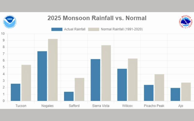
Source: NWS
The “Strange Science” Mechanics: Why It Turns On
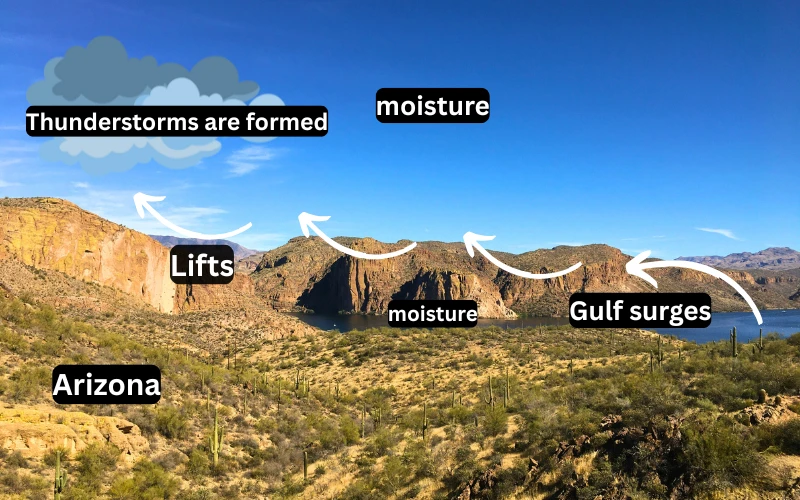
Think of the subtropical high-pressure system like a steering wheel that shifts each summer. As it migrates north and east, low-level winds help funnel moisture from the Gulf of California (and at times the Gulf of Mexico) into Arizona.
These pulses—often called Gulf surges — are the monsoon’s oxygen. With enough moisture and daytime heating, the desert becomes primed for convection.
Topography is the stagehand most people forget. The Mogollon Rim and Sky Islands (like the Santa Catalinas near Tucson) act as spark plugs, forcing air upward—exactly what thunderstorms want. On top of that, outflow boundaries from distant storms can act like mini cold fronts, colliding with warm, moist air to fire new cells closer to Phoenix and the valleys.
Add in occasional easterly waves/inverted troughs, and you’ve got extra lift.
For a deeper dive into how these factors interact, you can check The University of Arizona .
It’s like the desert has lungs. By late June, it starts inhaling moisture. By afternoon, thermal updrafts lift that air. If the cap breaks, storms grow anvils and the atmosphere exhales—sometimes as cool gusts and life-giving rain, sometimes as fierce microbursts.
Boom vs. Bust Years: Why It Varies So Much
You’ve probably noticed: some summers feel like a nightly light show; others barely sputter. One big player is ENSO (El Niño–Southern Oscillation). Just like Tornado Alley has been shifting east due to broader climate trends, Arizona’s monsoon also dances to the tune of large-scale patterns like ENSO.
While the relationship isn’t perfect, El Niño seasons often correlate with a later or weaker Arizona monsoon signal, whereas La Niña can sometimes favor better low-level flow and moisture returns.
But positioning of the Four Corners high, intermittent Gulf surges, and even soil moisture/land-surface feedbacks can tilt the scales week-to-week.
Hazards in Focus: Lightning, Microbursts, Flash Floods, Haboobs
Monsoon romance comes with real risk:
- Lightning: Arizona ranks high for thunderstorm days in summer—cloud-to-ground strikes come fast. If you hear thunder, you’re already within range.
- Microbursts: Downdrafts can slam the surface with dangerous straight-line winds—trees down, power knocked out, localized damage.
- Flash Floods: Dry washes aren’t dry when storms stall upstream. Slot canyons and urban low-water crossings are especially risky. Floods here highlight how water can be destructive—but in the right setting, like Wetlands can be a life-saving buffer against disaster.
- Haboobs (Dust Storms): Collapsing storms can shove a wall of dust across the desert, dropping visibility to near zero in minutes.
Fact: Across central and southern Arizona, a large share—often a third or more—of annual rainfall can arrive during the monsoon window (location dependent). That’s both a blessing (water recharge) and a challenge (flood control and safety).
City vs. Desert: Microclimates You Can Feel
Phoenix’s urban heat island can supercharge late-day instability but also complicate storm outflow interactions. Tucson’s proximity to higher terrain often gives it a different rhythm—earlier initiation over the mountains with evening spillovers. Along the Mogollon Rim, upslope-driven storms can be vigorous and frequent, with flash-flood risk in burn scars.
From years of watching radar loops: evening outflow collisions near the Valley can turn a quiet 5 PM into a chaotic 7 PM—when most folks are commuting or outdoors.
How I Forecast a Monsoon Day (My Checklist)
Here’s my real-world routine before I tell friends, “Yes, tonight’s a patio-watch”:
- Dew points & PWAT: Are we > 50–60°F dew points in the valleys? PWAT near climatology?
- CAPE & DCAPE: Enough buoyancy for updrafts; enough downdraft potential for strong outflows?
- Steering Flow: Will storms move into the valleys or die on the Rim?
- Morning Sounding: Any cap? What’s the mid-level temp doing?
- Hi-res guidance (HREF/HRRR): Not gospel—just timing/placement hints.
- Outflow History: Did last night’s storms seed boundaries that set the table?
What It Means for the Future
With hotter baselines and expanding urban footprints, expect more extremes at the edges — longer hot spells punctuated by short, intense storm windows. That means situational awareness is your best defense: know your washes, watch the sky, and build a routine around official forecasts.
Final thoughts
I love the monsoon because it’s nature’s reminder that the desert isn’t empty—it’s restless. If you live in Arizona, you already have a front-row seat. I shared my method and mindset; now I want yours. What hyper-local pattern have you noticed near your home that forecasts don’t capture—wind shifts, canyon jets, a “storm alley” on your street? Drop it in the comments; your note might help someone else plan a safer evening.
Disclaimer
This article is for information and education. Always follow official watches, warnings, and guidance from the National Weather Service and local authorities for real-time decisions.
Contents
- 1 What Exactly Is the Arizona Monsoon?
- 2 The “Strange Science” Mechanics: Why It Turns On
- 3 Boom vs. Bust Years: Why It Varies So Much
- 4 Hazards in Focus: Lightning, Microbursts, Flash Floods, Haboobs
- 5 City vs. Desert: Microclimates You Can Feel
- 6 How I Forecast a Monsoon Day (My Checklist)
- 7 What It Means for the Future
- 8 Final thoughts
- 9 Disclaimer