New forecasting tools could help communities prepare days earlier for dangerous winter storms hitting the West Coast.
A Crucial Winter for the West Coast
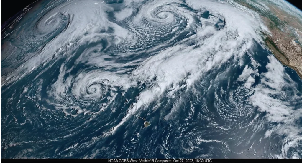
Atmospheric rivers are long, powerful bands of moisture that travel across the Pacific Ocean and hit the West Coast with heavy rain, strong winds, and flooding. In recent years, these storms have become stronger, harder to predict, and more dangerous.
This winter, the story is different.
NOAA has rolled out a major forecasting upgrade for 2025, designed to make atmospheric river predictions earlier, clearer, and far more accurate. When I first reviewed NOAA’s new update, one thing became very clear to me — this change could help millions of people across California, Oregon, and Washington prepare better for incoming storms.
What Are Atmospheric Rivers?
Atmospheric rivers (ARs) are:
- Long, narrow streams of water vapor in the sky
- Capable of carrying 15 times more water than the Mississippi River
- Responsible for 90% of California’s major flood damage
- A key source of snow for the Sierra Nevada
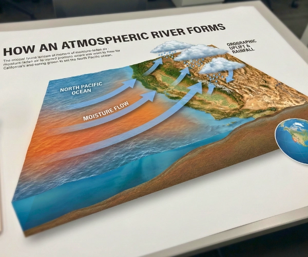
A visual explanation of how atmospheric rivers transport large amounts of moisture toward the West Coast.
AR Categories
- AR1 to AR5
- Higher category = stronger moisture + longer duration
“According to NOAA, atmospheric rivers will become more intense as ocean temperatures continue to rise.”
Why Forecast Accuracy Needed an Upgrade in 2025
The West Coast has seen back-to-back winters of severe storms. Older forecasting systems often struggled to predict where an atmospheric river would hit and how strong it would be.
Several new climate factors increased the need for better models:
- The Pacific Ocean is warmer than normal
- Storm systems are forming faster
- El Niño/La Niña swings are more sudden
- “Storm trains” — multiple ARs arriving one after another — are becoming common
Because of this, NOAA focused on improving speed, timing, and precision in atmospheric river forecasting.
NOAA’s New Forecasting System — What Changed in 2025?
This section uses a clean block-editor style for clarity.
- Expanded Sofar Ocean Buoy Network
NOAA partnered with Sofar Ocean to add more smart buoys across the Pacific, a move highlighted in their recent update on improving marine weather forecasts.
These buoys send real-time updates about:
- Wind
- Pressure
- Ocean temperature
- Wave conditions
This data helps scientists track where an atmospheric river is forming and how fast it is strengthening.
- High-Resolution Forecast Models (GEFS Upgrade)
NOAA upgraded its Global Ensemble Forecast System, making predictions:
- Up to 5 days earlier
- More accurate in storm track
- Better at estimating rainfall and flood risk
This is one of the biggest forecasting improvements in the last decade. NOAA’s upgraded satellite system is now able to track atmospheric rivers with much higher accuracy, as shown in their latest update on atmospheric river tracking.
- Better Satellite Data (JPSS + GOES)
New satellite upgrades allow NOAA to:
- Track moisture plumes more clearly
- Monitor atmospheric rivers over thousands of miles
- Predict landfall with fewer timing errors
- Machine-Learning Enhancements
Machine-learning tools now work with NOAA’s physical models to:
- Reduce forecast errors
- Improve intensity predictions
- Give more reliable rainfall maps for West Coast cities
Hurricane Hunters Also Helped Improve AR Forecasts
During the 2025 storm season, Hurricane Hunters collected massive amounts of data:
- Over 1,000 hours of storm flights
- Missions into three Category 5 storms
- Detailed measurements of moisture, temperature, and ocean-air interaction
This data helps NOAA understand how moisture travels across the Pacific — which directly improves atmospheric river forecasting.
“As I followed the Hurricane Hunter reports, it became clear how much their data helps strengthen West Coast storm predictions.”
Why California & the West Coast Need This Upgrade
- Earlier Flood Warnings (2–5 Days Faster)
Cities like :
- Los Angeles
- San Francisco
- Sacramento
- Seattle
- Portland
…can now receive warnings much earlier, giving emergency teams more time to act.
- Better Water & Snowpack Planning
Atmospheric rivers provide 30–50% of Sierra Nevada’s snowpack.
Accurate forecasts help:
- Reservoir managers
- Farmers
- Hydropower teams
- Lower Disaster Costs
Improved early warning can save millions in damages and protect more communities.
- Stronger Climate Adaptation Policies
Better forecasting supports:
- FEMA flood map updates
- Coastal planning
- Emergency response systems
What Scientists Are Saying
Climate researchers across the U.S. agree on one thing:
Atmospheric rivers are becoming more powerful because the Pacific Ocean is storing more heat.
NOAA’s AR Recon program continues to collect updated data, which will further improve forecasts through 2025 and 2026, according to scientists at UCAR and Scripps.
Dr. Marty Ralph of Scripps Institution notes that AR intensity has been rising “faster than historical averages.”
What This Means for Residents This Winter
Here’s how the public benefits directly:
- Faster and more accurate weather alerts
- Better flood preparation
- Safer travel decisions
- Higher trust in warnings
- Improved community planning
As someone who follows U.S. climate updates closely, I believe this upgrade will help reduce surprise storms and give the West Coast a much safer winter season.
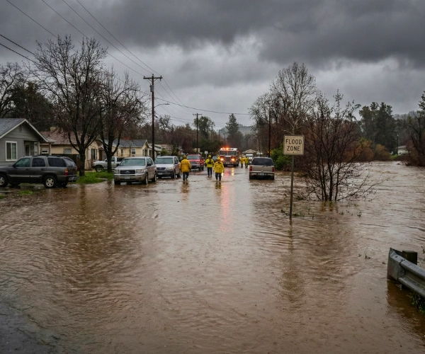
Flooding across parts of the West Coast caused by recent atmospheric river storms.
A More Prepared West Coast in 2025
NOAA’s 2025 forecasting upgrade marks a major step in protecting the West Coast from powerful atmospheric rivers. With better buoys, improved satellites, machine learning, and fresh storm data, forecasts are now clearer and earlier than before.
If 2025 brings another season of strong atmospheric rivers, this improved system may be the difference between early preparation and unexpected disaster.
Disclaimer
This article is based on information available from NOAA, scientific institutions, recent climate research and publicly reported data as of 2025. Forecasts, storm models and climate predictions may change as new information becomes available. This story is intended for general awareness and should not be used as an official safety or emergency guidance. For real-time updates or warnings, please follow NOAA, the National Weather Service and local authorities.

Contents
- 1 New forecasting tools could help communities prepare days earlier for dangerous winter storms hitting the West Coast.
- 2 A Crucial Winter for the West Coast
- 3 What Are Atmospheric Rivers?
- 4 AR Categories
- 5 Why Forecast Accuracy Needed an Upgrade in 2025
- 6 NOAA’s New Forecasting System — What Changed in 2025?
- 7 Hurricane Hunters Also Helped Improve AR Forecasts
- 8 Why California & the West Coast Need This Upgrade
- 9 What Scientists Are Saying
- 10 What This Means for Residents This Winter
- 11 A More Prepared West Coast in 2025
- 12 Disclaimer