
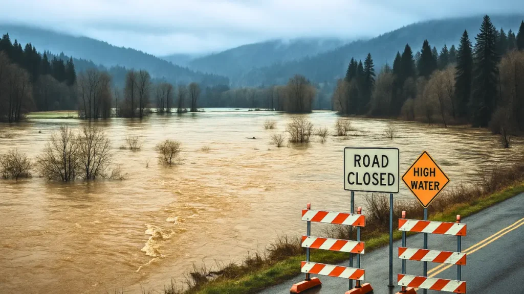
A powerful atmospheric river is driving prolonged heavy rain across Washington, raising rivers to dangerous levels, triggering widespread flood warnings, disrupting travel and daily life, yet forecasts hint at relief.
What Is Happening Under the Flood Warning in Washington?
A broad Flood Warning in Washington has been issued as a slow-moving storm channels deep Pacific moisture across the region. Continuous, heavy rain over many hours has pushed rivers, streams and urban drainage systems toward their limits.
In low-lying valleys and along major rivers, water is rising onto roads, fields and some residential areas, forcing difficult choices for families and authorities.
Emergency management teams are closely tracking river gauges and rainfall totals to decide when to recommend voluntary evacuations and when to order mandatory ones. In some locations, sandbags line streets and driveways as residents work to keep water out of homes and businesses.
Travel has become increasingly hazardous in flood-prone corridors, with standing water, debris and reduced visibility combining to create a dangerous mix on the roads.
While not every community is experiencing the same level of impact, the ongoing Flood Warning in Washington means conditions can change quickly, even in areas that seemed safe only a few hours earlier.
How an Intense Atmospheric River Is Fueling the Flood Threat?
The main driver behind the current Flood Warning in Washington is an intense atmospheric river a long, narrow band of air carrying huge amounts of water vapor from over the ocean.
When this “river in the sky” encounters the cooler air and mountainous terrain of Washington, the moisture condenses and falls as heavy rain, especially along and west of the Cascades.
Unlike a brief thunderstorm, an atmospheric river can stay focused on the same region for an extended period. This event has already produced repeated rounds of moderate to heavy rainfall, with only short breaks in between.
As the soils become saturated, the ground can no longer absorb additional water efficiently, forcing more runoff into creeks and rivers. This combination of persistent rain, saturated ground and already elevated waterways greatly increases flood risk.
Even modest additional rainfall can cause sharp rises in river levels. That is why forecasters emphasize that the Flood Warning in Washington is not just about how hard it rains in any single hour, but how long the overall pattern continues.
Areas at Highest Risk During the Flood Warning in Washington
Under the ongoing Flood Warning in Washington, not all locations face the same level of threat. The highest-risk areas typically share several characteristics. They are often close to major rivers or their tributaries, especially in broad floodplains that have flooded in previous years.
They may sit downstream from steep hillsides where runoff quickly funnels into narrow channels, or near levees and dikes that can be stressed by prolonged high water.
Latest Washington weather data shows rivers surging as the intense atmospheric river peaks.
Rural lowlands and agricultural regions frequently bear the brunt of rising river levels, with fields, barns and access roads going underwater. In more urban settings, the risk often comes from overwhelmed storm drains, clogged culverts and underpasses where water can pool quickly.
Neighborhoods built near creeks or drainage ditches may see water creeping into yards and basements. Officials warn that people living near rivers, streams, wetlands and known flood zones should pay especially close attention to local alerts.
Even if conditions appear calm at a given moment, upstream rainfall can send a surge of water downstream hours later, intensifying the Flood Warning in Washington with little direct warning on the ground.
How Authorities and Communities Are Responding
Emergency response activation
- State and local agencies have activated emergency operations centers to coordinate efforts.
- Meteorologists, hydrologists, transportation officials and first responders are sharing real-time information.
- They are tracking conditions and deciding where resources are most urgently needed.
- High-water vehicles and rescue boats are being placed near vulnerable areas for rapid evacuations or rescues.
Local government actions
- Local governments are issuing advisories about road closures and detours.
- They are warning residents about landslide-prone zones.
- Temporary shelters are on standby or already open for people who need to leave their homes.
- Utility crews are on alert for outages caused by saturated ground, fallen trees or damaged infrastructure.
Community and neighborhood efforts
- Residents are taking practical steps to protect their homes and property.
- Volunteers are helping fill sandbags and check on elderly neighbors.
- People are moving vehicles and valuables to higher ground.
Overall impact of these actions
- Community-level efforts, combined with official preparations, are a major reason authorities are cautiously optimistic.
- Together, they hope to limit the worst outcomes from this Flood Warning in Washington.
Safety Tips to Follow While the Flood Warning in Washington Remains in Effect
During the ongoing Flood Warning in Washington, small decisions can make a big difference. Keep these key safety tips in mind:
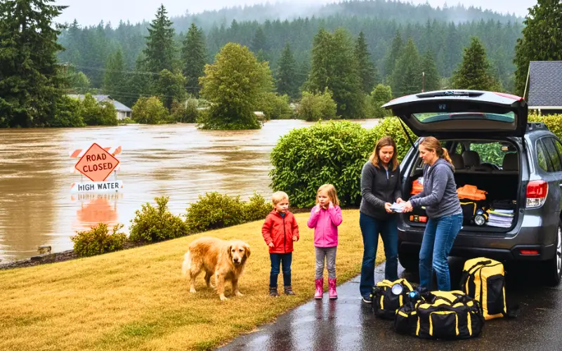
- Avoid flooded roads
- Never drive through floodwater, even if it looks shallow.
- The road underneath may be damaged, missing or deeper than it appears.
- Keep children and pets safe
- Stay away from fast-moving streams, swollen ditches and ponds.
- Flooded banks can collapse suddenly and currents can be very strong.
- Prepare an emergency go-bag
- Include documents, medicines, food, water, flashlights, batteries and chargers.
- Keep it in an easy-to-grab place in case you need to leave quickly.
- Have an evacuation plan
- Decide in advance where you will go: higher ground, a friend or family home, or an official shelter.
- Follow trusted information sources
- Rely on the National Weather Service, local authorities and official alerts.
- Avoid acting on rumors or unverified social media posts.
Conclusion
The current Flood Warning in Washington highlights how vulnerable communities can become when an intense atmospheric river stalls over the region. Prolonged heavy rain, saturated ground and rising rivers have combined to create serious flooding concerns, travel disruptions and difficult choices for residents and officials alike.
Disclaimer: This article is for informational purposes only and does not constitute emergency advice. Always follow guidance and official alerts from local authorities and the National Weather Service during events.

Contents
- 1 A powerful atmospheric river is driving prolonged heavy rain across Washington, raising rivers to dangerous levels, triggering widespread flood warnings, disrupting travel and daily life, yet forecasts hint at relief.
- 2 What Is Happening Under the Flood Warning in Washington?
- 3 How an Intense Atmospheric River Is Fueling the Flood Threat?
- 4 Areas at Highest Risk During the Flood Warning in Washington
- 5 How Authorities and Communities Are Responding
- 6 Safety Tips to Follow While the Flood Warning in Washington Remains in Effect
- 7 Conclusion