Heavy snow, powerful winds, and freezing rain are putting millions at risk of power outages across the Northeast today.
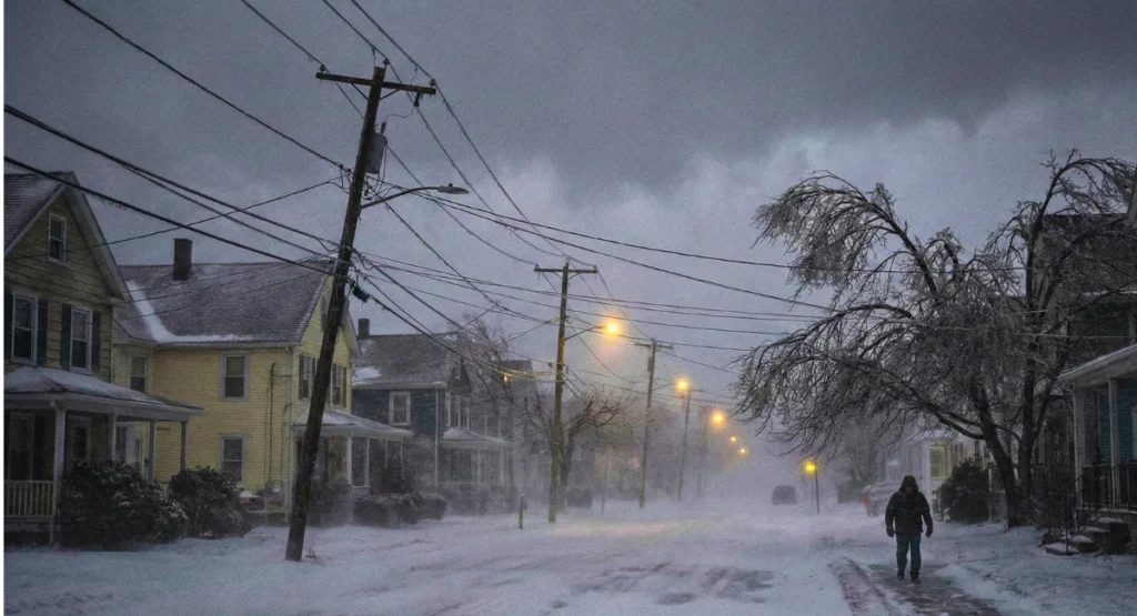
A strong winter storm is moving across the Northeast today, bringing heavy, wet snow, strong winds, and a rising risk of power outages across several states.
When I checked early reports this morning, many areas were already seeing line damage, fallen branches, and scattered outages.
Heavy, Wet Snow Is Putting Pressure on Power Lines
Wet snow is one of the main reasons the power grid is struggling today.
It sticks to wires, trees, and poles — and becomes extremely heavy.
Snowfall estimates so far :
- New York: 6–12 inches
- Pennsylvania: 5–10 inches
- Massachusetts: 8–14 inches
- Connecticut & Rhode Island: 4–8 inches
This type of snow can overload power lines quickly. Several counties in New York, New Jersey, and Pennsylvania have already reported small outages. More than 50 million people are under winter storm warnings issued by the National Weather Service.
Strong Winds Are Making the Situation Worse
Wind gusts across the Northeast are reaching 40–55 mph, with some coastal and elevated areas seeing up to 60 mph. According to the latest wind gust forecast, several coastal areas may experience even higher gusts as the storm strengthens.
These winds :
- Shake snow-covered wires
- Break older power poles
- Push tree branches onto lines
- Create transformer failures
As I watched the live NWS feed, it was clear the situation was getting worse as winds increased through the afternoon.
According to real-time data shared by Windy.com, the winter storm is impacting both the Northeast and Midwest with heavy snow, snow squalls, flight delays, and strong winds.
Ice Build-Up Is Creating Even Higher Outage Risks
Parts of Pennsylvania, New Jersey, and Connecticut are dealing with freezing rain.
Ice is even more dangerous than snow because it forms a solid layer around wires.
Current ice accretion reports :
- 0.10 – 0.20 inches of ice in several counties
- Enough to cause scattered outages and tree breaks
If ice continues to build, outage numbers may rise sharply.
Areas Facing the Highest Power Outage Risk
Based on current weather behavior and early utility reports:
- New York — heavy snow + strong winds
- Pennsylvania — freezing rain + tree fall risk
- New Jersey — wet snow + coastal wind gusts
- Massachusetts — wind + inland snow pressure
- Connecticut & Rhode Island — snow turning to ice
- Vermont, New Hampshire, Maine — flash freeze risk
These states have the perfect combination of snow, ice, and wind, along with large areas of above-ground power lines.
Here’s a closer look at the storm pattern that’s creating dangerous wind and power outage threats:
Outages Already Reported Across the Region
According to early PowerOutage.us data:
- Outages have already appeared in PA, NJ, NY, and MA
- Utility companies expect the numbers to rise as winds peak
- Tree damage and ice accumulation remain the main causes
Crews from Con Edison, Eversource, PSE&G, and National Grid are on standby for overnight repairs. Early reports show scattered outages in several states, and the live outage tracker is already showing rising numbers across Pennsylvania, New Jersey, New York, and Massachusetts.
Why This Storm Has Higher Outage Potential Than Usual
This isn’t a normal early-season winter storm.
Based on the models I checked, several factors are increasing the outage risk:
- The jet stream dipped sharply south, pulling in more moisture
- The storm intensified faster than expected
- The ground isn’t fully frozen, making it easier for trees to fall
- The Northeast grid is aging and more vulnerable
This mix creates a “perfect storm” for power failures.
Travel and Daily Life Also Impacted
Power outages affect much more than electricity.
They influence travel, communication, and heating.
Current impacts :
- 2,000+ flights delayed
- Multi-vehicle accidents on icy roads
- Slower train services along major routes
- Cell towers may lose backup power
- Heating systems may stop during outages
Road conditions are especially dangerous during the evening hours as snow turns to ice.
What You Should Do If Power Goes Out
Here is a simple checklist anyone can follow:
- Charge phones, laptops, and power banks
- Keep flashlights and extra blankets ready
- Stay away from any downed wires
- Avoid driving during peak winds
- Do not use gas stoves for heating
- Report outages to your local utility company
These steps can help residents stay safe until crews restore power.
What to Expect in the Next 12–24 Hours
The storm is expected to continue into tonight with high winds and additional snowfall in some areas.
A rapid temperature drop may create a flash freeze across New York, Vermont, and New Hampshire.
Utility companies have warned that repair times may be slower due to:
- Strong wind gusts
- Falling branches
- Hardening ice
Some forecasters also mention a second system developing behind this one, which could bring more snow later this week.
As I looked at the updated radar, it was clear the region may not get a long break between storms.
Conditions to Watch in the Next 24 Hours
Power outage risks will stay high tonight as snow, ice, and strong winds continue across the Northeast. Residents should follow National Weather Service alerts and listen to local authorities for safety updates.
Disclaimer
This article is based on information from the National Weather Service, NOAA, and publicly available reports at the time of writing. Weather conditions can change quickly, so readers should rely on official alerts and local authorities for the most accurate and updated guidance.

Contents
- 1 Heavy snow, powerful winds, and freezing rain are putting millions at risk of power outages across the Northeast today.
- 2 Heavy, Wet Snow Is Putting Pressure on Power Lines
- 3 Snowfall estimates so far :
- 4 Strong Winds Are Making the Situation Worse
- 5 Ice Build-Up Is Creating Even Higher Outage Risks
- 6 Areas Facing the Highest Power Outage Risk
- 7 Outages Already Reported Across the Region
- 8 Why This Storm Has Higher Outage Potential Than Usual
- 9 Travel and Daily Life Also Impacted
- 10 What You Should Do If Power Goes Out
- 11 What to Expect in the Next 12–24 Hours
- 12 Conditions to Watch in the Next 24 Hours
- 13 Disclaimer