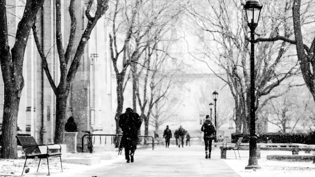
As winter tightens its grip earlier than expected, the National Weather Service (NWS) has issued a Winter Storm Warning for several U.S. states across the Midwest, Great Plains, and Northeast. The alert warns of heavy snowfall, icy roads, strong winds, and dangerous travel conditions expected to persist through mid-November.
According to NWS meteorologists, an Arctic cold front sweeping down from Canada is colliding with moist Gulf air — the perfect setup for widespread snowstorms and freezing rain.
This weather system has already blanketed parts of Minnesota, Wisconsin, North Dakota, and Michigan, with forecasts predicting the storm will intensify as it moves eastward toward New York, Pennsylvania, and New England.
What Does a Winter Storm Warning Mean?
A Winter Storm Warning is the NWS’s highest-level advisory for severe winter weather, issued when significant snowfall or ice accumulation is either imminent or already occurring.
This alert means residents should avoid unnecessary travel, prepare for power outages, and stay tuned to official weather updates.
The NWS defines a winter storm warning as one that meets or exceeds the following conditions:
- Snowfall of 6 inches or more in 12 hours, or 8 inches or more in 24 hours.
- Sleet or freezing rain capable of causing hazardous travel or power disruptions.
- Wind gusts above 35 mph, creating blizzard-like visibility conditions.
Regions Currently Under Warning
As of Monday morning, Winter Storm Warnings remain in effect across:
- Upper Midwest: Minnesota, North Dakota, Wisconsin
- Great Lakes Region: Michigan, Illinois, Indiana
- Northeast Corridor: New York, Vermont, New Hampshire, Maine
- Northern Plains: South Dakota, Nebraska
The Northeast is expected to receive 8–12 inches of snow, with inland areas facing sleet and freezing rain. New York City, Boston, and Philadelphia may see a mix of rain and snow, while Buffalo and Syracuse brace for heavier accumulation.
The Midwest is already reporting snow drifts up to two feet in northern Minnesota, prompting local officials to declare travel emergencies in several counties.
Air Travel and Road Disruptions
The Federal Aviation Administration (FAA) has reported widespread flight delays and cancellations across major airports, including Chicago O’Hare, Minneapolis-St. Paul, and Boston Logan International Airport. Airlines have issued travel waivers to passengers scheduled for early-week departures.
Interstate highways such as I-90, I-94, and I-35 are seeing treacherous driving conditions due to low visibility and icy patches.
Authorities are urging motorists to:
- Keep an emergency kit with blankets, flashlights, and non-perishable food.
- Check real-time road updates through state transportation apps.
- Avoid travel during peak storm hours unless absolutely necessary.
Power Outages and Grid Concerns
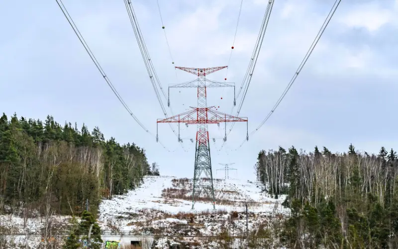
The combination of ice accumulation and strong winds has caused power outages across parts of Wisconsin, Minnesota, and Michigan. Utility companies including Xcel Energy and Consumers Energy have dispatched crews to restore power as temperatures plunge below freezing.
Energy experts warn that prolonged freezing conditions could strain local grids, especially if ice damages transmission lines. The Department of Energy has placed several regional power authorities on standby alert to prevent cascading blackouts similar to those seen during the 2021 Texas freeze.
How the Storm Is Evolving
Meteorologists at the National Oceanic and Atmospheric Administration (NOAA) predict this storm will continue tracking east-northeast, affecting New England by midweek.
Forecast models suggest:
- Heaviest snowfall: Northern New York, Vermont, and Maine
- Freezing rain threat: Pennsylvania and parts of Ohio
- Cold wave impact: Plains and Midwest with subzero wind chills
In the Rocky Mountains, earlier snow has already boosted early ski-season conditions, while Colorado and Wyoming remain under Winter Weather Advisories.
Meanwhile, the Pacific Northwest is monitoring another potential storm forming over the Pacific, expected to hit the West Coast next week.
Government & Emergency Response
State governments and emergency agencies are preparing for possible disruptions:
- FEMA has pre-positioned supplies, including generators and heating kits, in the Midwest.
- The National Guard has been placed on standby in North Dakota and Michigan.
- Several school districts have announced closures or remote learning days.
- Local shelters are expanding capacity for the homeless and vulnerable populations during the deep freeze.
In a public statement, the NWS reiterated:
“This is not a routine snow event. Travel will become difficult to impossible in some regions. Residents are urged to take warnings seriously and prepare accordingly.”
Economic and Environmental Impact
Economists estimate that severe winter storms cost the U.S. economy $1–3 billion annually, largely due to transportation delays, power repairs, and business shutdowns.
Environmental experts also highlight how climate change may be altering storm patterns — causing heavier snowfall events in regions unaccustomed to them.
The NOAA Climate Prediction Center recently noted that warmer ocean temperatures can intensify moisture content in the atmosphere, resulting in stronger snowstorms when Arctic air collides with these systems.
What to Expect Next
The current Winter Storm Warning is expected to remain active through Thursday evening, with tapering snow on Friday. However, secondary cold waves are likely to follow through Thanksgiving week.
Residents from Montana to Maine are advised to stay alert for updated warnings, as shifting jet stream patterns could trigger new snow events into late November.
Disclaimer: This image is for illustrative purposes only, depicting power lines during U.S. winter storm warnings. Actual weather conditions and grid impacts may differ. Refer to official National Weather Service updates for accurate regional information.